Our tour began at ALCOSAN then headed up and down the hills of Marshall-Shadeland. See our full hike here.
Up next: Marshall-Shadeland hike plus bonus ALCOSAN tour
7 09 2012Urban Hike loves to explore new perspectives in Pittsburgh and our September 15 hike in Marshall-Shadeland is no different. Not only will we take in this city neighborhood’s streets and sights from above, we’ll look into what’s below too! Our hike starts early at the ALCOSAN (that’s short for Allegheny County Sanitary Authority) plant that provides wastewater treatment services to 83 communities including the City of Pittsburgh. You’ll never look at a drain the same again.
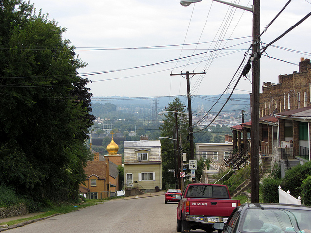 After the ALCOSAN bus tour concludes, we’ll get our exercise on by climbing some of Marshall-Shadeland’s hills. This hike will be a bit brisker than most, with fewer stops to outweigh the extra time we’ll spend on the tour at the beginning. But just in case you’re not convinced to come out, rain or shine, with us… we’ll sweeten the deal just a bit more. A pit stop at a neighborhood ice cream and coffee café. Yum.
If you are coming on the hike, we ask that you please RSVP to Emily at emilykeebler(at)yahoo.com by Thursday, September 13 so we can give ALCOSAN a headcount.
Here’s the recap:
What: Urban Hike’s Marshall-Shadeland hike
When: September 15 at 9:30 a.m.
Where: Meet in front of the red LED sign that marks the entrance to the ALCOSAN plant. It’s just past the intersection of New Beaver Street and Tracy St., 15233. Public parallel parking is available on the nearby side streets, so give yourself a few extra minutes to park and join us at the sign.
Why: Sewers and sweets?! What’s not to love?
Comments : 5 Comments »
Categories : Uncategorized
Save the date — September 15
25 08 2012Only Urban Hike would take you on a neighborhood tour that potentially involves city sewers and a cafe’n’creamery! While we are still working out the time and details, please mark September 15th on your calendar for the next Urban Hike.
Questions in the meantime? As always, you can find us at info@urbanhike.com
Comments : Leave a Comment »
Categories : Uncategorized
Sheraden hike pictures
31 07 2012Points of interest included Sheraden Park, Brunot Ave. overlook, Pittsburgh Fire Station No. 31, Langley High School, and Smitty’s Bar and Restaurant. Follow our route here.
Comments : Leave a Comment »
Categories : Uncategorized
Go West for an Urban Hike in Sheraden
23 07 2012“Together. We will go our way.
Together. We will leave someday.”
Well, that day is coming soon! On Saturday, July 28 at 10:00 a.m., Urban Hike will head west to the Pittsburgh neighborhood of Sheraden.
“Go West. Life is peaceful there.
Go West. In the open air.”
Well, we’ll still be in the city, but we’ll walk through Sheraden Park, a hidden gem with trails, a pool, and much more. We’ll also wind our way up a hillside to take in a great view of the Ohio River and downtown. Along with the peaceful scenes we will talk to the neighborhood’s City Council representative, Theresa Kail-Smith, who is working hard to bring exciting projects to Sheraden, as well as other residents who can tell us about the unique features of the neighborhood.
We will start the hike at the Sheraden branch of the Carnegie Library of Pittsburgh (720 Sherwood Avenue, Pittsburgh, PA, 15204). Bring all the usual hike stuff — sunscreen, good walking shoes, and a water bottle, and be prepared to cover about 4.5 miles, including city steps and steep hillsides. There will be a restaurant option at the end, so bring your appetite too.
“Go West. This is our destiny.”
Comments : Leave a Comment »
Categories : Uncategorized
Save the date for Sheraden
12 07 2012Urban Hike hasn’t visited the western neighborhoods of Pittsburgh since 2004, so you don’t want to miss this one! Join us, and special guest Councilwoman Theresa Kail-Smith, in Sheraden on the morning of Saturday, July 28. More details to come soon!
Comments : Leave a Comment »
Categories : Uncategorized
June 3 — Strip District hike takes off
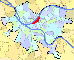
30 05 2012We know you have been on the edge of your seat, and we have been working hard to put together a great hike for you in the Strip District! We will meet on Washington’s Landing/Herr’s Island at 11:00 a.m. on Sunday June 3. The parking lot is underneath the 31st Street bridge, on your left as you are driving upriver towards the tennis courts.
As a word of warning, the entrance to the 31st Street bridge from Route 28 is closed due to construction. You will need to get onto the island from the Strip District side of the river, or from River Ave. Some cursory testing seemed to indicate that Google Maps understands these dynamics, but if you have any questions about navigation, don’t hesitate to contact us. Due to the construction we will give a traffic update on the weekend prior to the hike.
And on to the fun stuff… we will walk for about five miles, with a few stops along the way to whet (or wiggle) your whistle. Even so, bring lots of water and don’t forget sunscreen, although we hike rain or shine. We look forward to seeing some of modern Pittsburgh’s oldest history and newest developments – this is a hike you don’t want to miss!
 Recap:
What: Urban Hike in the Strip District
When: Sunday, June 3 at 11:00 a.m.
Where: Meet at Washington’s Landing
Who: You, your friends, their friends, and people who might become new friends!
Comments : Leave a Comment »
Categories : Uncategorized
Save the date! June 3 is next Urban Hike
22 05 2012Have you ever wanted to see a “Strip Show”? Well, have we got one for you! Urban Hike ventures into Pittsburgh’s historic Strip District on Sunday, June 3 to visit perhaps some familiar landmarks, and introduce a few less well known sites.
We’ll “expose” all the details soon, so for now plan on spending a couple of hours walking 4 or 5 miles, with stops along the way for local culture and history.
See you soon!
P.S. For those of you who may be new to the area, the Strip District is actually a strip of land along the Allegheny River, filled with shops, restaurants, and history. It is in no way a red light district. And please forgive the puns — we simply could not say no to the temptation.
Comments : 1 Comment »
Categories : Uncategorized
4/28 — Beechview hills await!
8 04 2012Spring is finally here! Well, maybe spring came a few weeks ago, then we had summer and now we are back to spring (or maybe winter?), but whatever the weather, Urban Hike is ready to go!
We are kicking off the 2012 season in Beechview on April 28th. We will meet at 10:00 a.m. at BREW on Broadway Ave. (1557 Broadway Ave. – map) Free street parking is available on Methyl Street, on ether side of Hampshire Ave., or there is a parking lot off Broadway near the intersection of Hampshire Ave. and Fallowfield Ave. It’s $0.25 for 15 minutes, with parking allowed for up to four hours. The hike should last about three and a half hours or so.
Don’t want to deal with parking (or with driving on the steep and twisting Beechview streets)? Why not take the T! The Broadway Ave. at Hampshire stop is just a few steps from BREW.
If you think you’ve seen Pittsburgh’s hills before, you haven’t seen anything until you’ve been to Beechview. Bring your sturdy walking shoes, and your endurance, as this hike will take us up and down numerous hills, and might possibly set the record for most number of city steps encountered on a single urban hike. We’ll be walking about four miles, with a few stops along the way. Don’t forget to bring water, snacks, and sunscreen, although we will hike rain or shine.
Recap:
Where: Beechview, meet at BREW on Broadway (map)
When: April 28th, 10:00 a.m.
What: Urban Hike
Who: Come one, come all, and bring friends
Questions? Contact info@urbanhike.org
Comments : 1 Comment »
Categories : Uncategorized
Sneak peak!
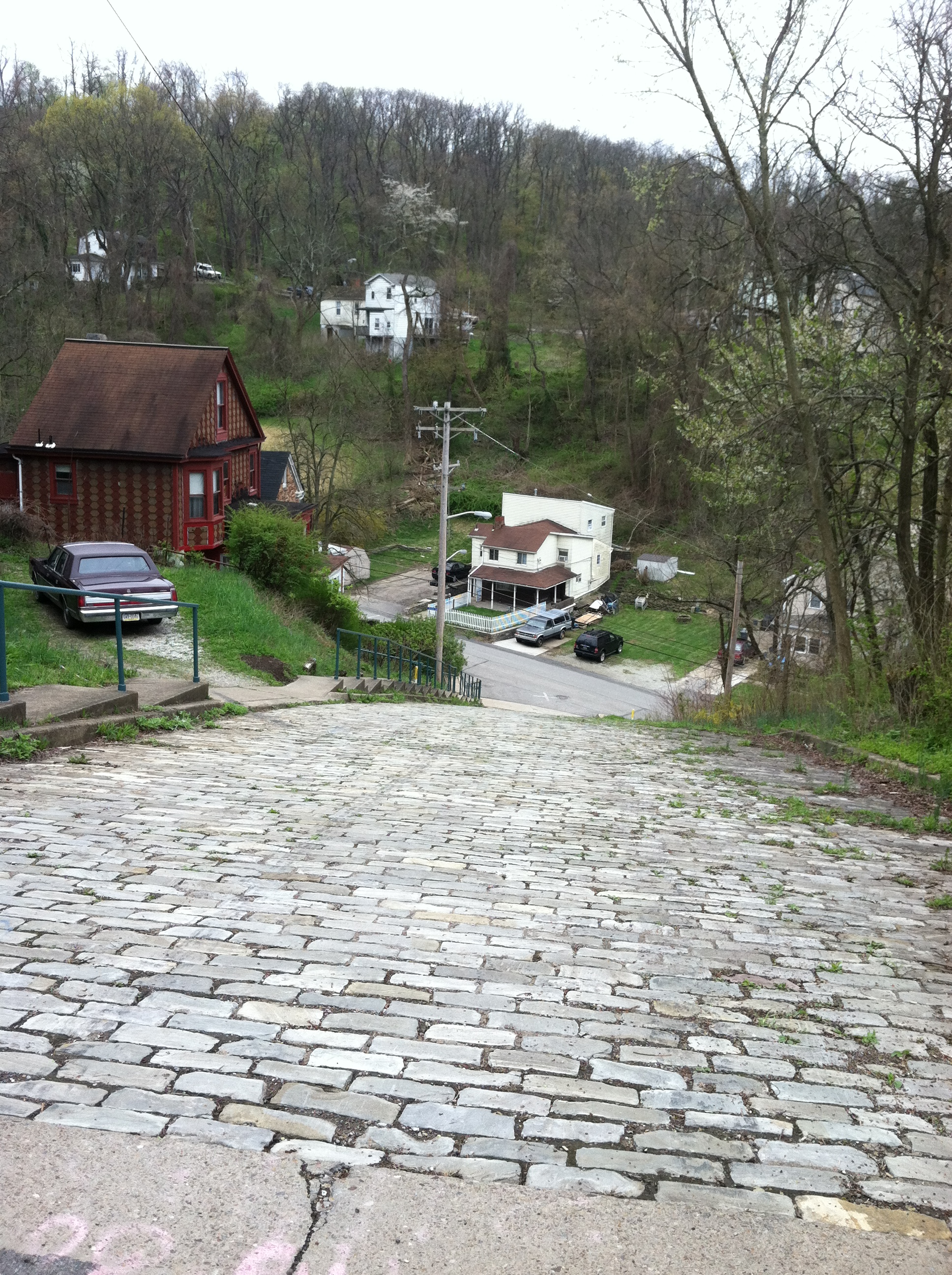
3 04 2012Your Urban Hike planning team got out this past weekend to do a test run of our upcoming route…check out this sneak peak of one of the neat things we will see on the hike…the steepest street in Pittsburgh! (Don’t worry, we’re walking down this one…)
Comments : Leave a Comment »
Tags: outdoors, urban hike
Categories : Uncategorized